Haven't had much time to blog over the past few weeks - work has been busy with the Pattullo Bridge going down and the recent flooding in the Lower Mainland due to the snowfall. This blog was just one more thing on my plate to fix up so I've got a new look now. That masthead picture is the next thing to change too (as much as I like Vegas.... it's just not geocorrect here...!)
But I do need to mention that I'm off to the Burnaby Hilton Hotel for the biannual URISA BC Workshop. This one will have a range of speakers on the use of 3D tools in the geospatial toolkit. There's been a lot of interesting developments in the past couple of years (much more than Sketchup models of buildings in Google Earth!) so it'll be good to hear what's going on around town.
Later!
Wednesday, 21 January 2009


Friday, 12 December 2008
The Best of 604 on the Interwebs
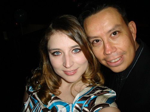
Miss 604, a local blogger, profiles the Best of 604 Web Awards, held last night at The Cellar, a good little club/bar in downtown Vancouver. If you want the lowdown on the best bloggers in Van City covering everything from local politics to food and photography, check it out.
Photo credit: Raul on Flickr
Safe Software Open House: Tuesday Dec 16
A bunch of us here at the City are heading out to the Open House next week. Should be good to meet up with some old BCIT classmates and see what is going on these days. Last I was there was back in 2005 - a few of us took their intro FME class.
Here's some of Safe's blogs for further reading....
Dale Lutz, The Corporate Blog of Safe Software
The FGE Evangelist, the newletter blog that "delivers insider news, cutting edge examples and the latest functional developments for Safe Software’s FME application."
Here's some of Safe's blogs for further reading....
Dale Lutz, The Corporate Blog of Safe Software
The FGE Evangelist, the newletter blog that "delivers insider news, cutting edge examples and the latest functional developments for Safe Software’s FME application."
Thursday, 20 November 2008

Wednesday, 19 November 2008
GIS Day 2008 - Back to Blogging
It's been a busy, busy year. Everything from a new job here at the City of Surrey, to getting married, to getting back on track with this blog. Maybe James will let me back on Planet Geospatial if I get more consistent!
Today is GIS Day in North America and I've resolved to try and blog at least once a week. We'll see how it goes (must remember these handy tidbits)....
So.... here's a few things happening in Metro Vancouver around GIS Day 2008.
ESRI Regional User Conference: Vancouver. Note to self: Taking place in Burnaby....?
If you need more info on managing your rasters and mobile GIS solutions, this is good place to get the info.
Ron Lake, of locally based Galdos Systems, has blogged about the Geoweb & eGovernance.
URISA BC will holding their winter one-day conference in January 2009. Topic: GIS Analysis and 3D Modelling. These local URISA seminars are pretty good for meeting fellow GIS'ers in municipal gov't and the projects they've worked on lately.
Today is GIS Day in North America and I've resolved to try and blog at least once a week. We'll see how it goes (must remember these handy tidbits)....
So.... here's a few things happening in Metro Vancouver around GIS Day 2008.
ESRI Regional User Conference: Vancouver. Note to self: Taking place in Burnaby....?
If you need more info on managing your rasters and mobile GIS solutions, this is good place to get the info.
Ron Lake, of locally based Galdos Systems, has blogged about the Geoweb & eGovernance.
URISA BC will holding their winter one-day conference in January 2009. Topic: GIS Analysis and 3D Modelling. These local URISA seminars are pretty good for meeting fellow GIS'ers in municipal gov't and the projects they've worked on lately.
Wednesday, 14 November 2007
A late GIS Day entry...
Here's to GIS Day. It's been a few months since my last post but a lot has happened lately. A month long vacation in July meant a maddening amount of frenzied mapping of ECD trends to do in August & Sept. So much so that I had banked a copious amount of flex time (like 2 weeks).
Nevermind the conference in Ottawa - it was great to hear how CDN GIS professionals are starting to merge health data with spatial analysis tools. Some were basic - from "I mapped SES data according to our local boundaries" to developed spatial multi-variate models of traffic accidents in the Island of Montreal. Professionally, it was great to meet other GIS professionals that I had only e-mailed or heard about through local Health Networks. I even managed to check out Ottawa and scowl at the cheap real estate prices (compared to Vancouver anyway).
But after it was all said and done, I've moved on from working at the Human Early Learning Partnership & UBC. Making maps and cartographically styled posters was great but I felt I needed to get back to municipal GIS and flex my old programming skills, especially in ArcGIS. So I'm now at the City of Surrey in the Engineering GIS Section. (Here's the job description.)
My first 3 weeks have been busy - various sections within Engineering rely on the Section for a lot of maps, mostly for Corporate Reports in their reports. Other times require different custom maps so I've gotten used to using templates again in ArcMap. Due to the nature of the work, there isn't a lot of need to have stylized maps created via the "Export-to-AI" route as I did before at HELP. ArcGIS (9.1, phew!) fits the bill for these quick and simple maps. I doubt I'll have to make a cartogram anytime soon.
Unlike the rapid upkeep of the computer systems at UBC, the corporate IT environment is still running on Windows 2000. And Internet Explorer. Ugh. I soooooo miss my Firefox browser at work.
Thankfully, they are heading to Vista in a few months. Skipping XP entirely. It's going to be a wild ride for the oldtimers in the City. ;)
(Maybe if gets to be too much, we can spend some time devoted to planned next year's Halloween festivities....)
Nevermind the conference in Ottawa - it was great to hear how CDN GIS professionals are starting to merge health data with spatial analysis tools. Some were basic - from "I mapped SES data according to our local boundaries" to developed spatial multi-variate models of traffic accidents in the Island of Montreal. Professionally, it was great to meet other GIS professionals that I had only e-mailed or heard about through local Health Networks. I even managed to check out Ottawa and scowl at the cheap real estate prices (compared to Vancouver anyway).
But after it was all said and done, I've moved on from working at the Human Early Learning Partnership & UBC. Making maps and cartographically styled posters was great but I felt I needed to get back to municipal GIS and flex my old programming skills, especially in ArcGIS. So I'm now at the City of Surrey in the Engineering GIS Section. (Here's the job description.)
My first 3 weeks have been busy - various sections within Engineering rely on the Section for a lot of maps, mostly for Corporate Reports in their reports. Other times require different custom maps so I've gotten used to using templates again in ArcMap. Due to the nature of the work, there isn't a lot of need to have stylized maps created via the "Export-to-AI" route as I did before at HELP. ArcGIS (9.1, phew!) fits the bill for these quick and simple maps. I doubt I'll have to make a cartogram anytime soon.
Unlike the rapid upkeep of the computer systems at UBC, the corporate IT environment is still running on Windows 2000. And Internet Explorer. Ugh. I soooooo miss my Firefox browser at work.
Thankfully, they are heading to Vista in a few months. Skipping XP entirely. It's going to be a wild ride for the oldtimers in the City. ;)
(Maybe if gets to be too much, we can spend some time devoted to planned next year's Halloween festivities....)
Saturday, 8 September 2007
Off-Topic but Blogging for a Great Photo.
I've always had a avid hobby of photography but hardly get around to recommending anyone.... until now.
Local Vancouver Photographer and blogger, Duane Storey is giving away 8×12 prints of his beautiful photography to the first 20 people who post about his new photo blog.
So I'm putting in my 2 cents for a copy of this fabulous shot of Kitsilano Pool in Vancouver. The lighting he gets from his shots are amazing. I can only wish to replicate something close to that with my film SLR one day.

If you were in town during the Annual URISA Conference this summer and want a great photo to remind you of the City, I'd also recommend this one of the Burrard Street Bridge.
Local Vancouver Photographer and blogger, Duane Storey is giving away 8×12 prints of his beautiful photography to the first 20 people who post about his new photo blog.
So I'm putting in my 2 cents for a copy of this fabulous shot of Kitsilano Pool in Vancouver. The lighting he gets from his shots are amazing. I can only wish to replicate something close to that with my film SLR one day.
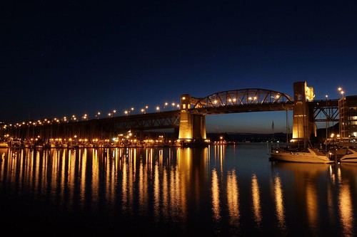
If you were in town during the Annual URISA Conference this summer and want a great photo to remind you of the City, I'd also recommend this one of the Burrard Street Bridge.
Wednesday, 8 August 2007
Nanaimo's love affair with Google Earth
I just ran across an article written in Canada's national newspaper, the Globe & Mail about the availability of the City of Nanaimo's geospatial information in Google Earth.
According to the article, Nanaimo has become "the world's most active supplier of geographic data" to GE.
Congrats to Jason Birch and the team at the City of Nanaimo. The work looks amazing on GE. Check it out yourself!
According to the article, Nanaimo has become "the world's most active supplier of geographic data" to GE.
Congrats to Jason Birch and the team at the City of Nanaimo. The work looks amazing on GE. Check it out yourself!
Wednesday, 4 July 2007
Tourism Maps for Vancouver
Before I leave for my month-long vacation to Paris and Portugal tomorrow (it happens when you've accumulated it all over the year in a new job), I thought I'd add a link to a cool website called Gridskipper, "the decadent urban travel guide. [They] Scour[ing] the globe for chic hotels, hot restaurants, sweet nightlife, and pretty people."
Tips on things to do and places to see are demarked by cities across the globe and tips are mashed with Google Maps as a result. It's been useful for my own personal research.
Not a bad place to get your bearings too when you are there. Here's Vancouver's Gridskipper site, although it would be nice to see it updated a little more often.
Tips on things to do and places to see are demarked by cities across the globe and tips are mashed with Google Maps as a result. It's been useful for my own personal research.
Not a bad place to get your bearings too when you are there. Here's Vancouver's Gridskipper site, although it would be nice to see it updated a little more often.
Friday, 15 June 2007
Cool Facebook app: Where I've Been
I've recently joined Facebook and like many others, I've been sucked in. Badly. (Not at work. Honestly. Open office = too many people can see my monitor = bad work impressions. And I've got waaaaay too much to do.)
Anyway, one of the coolest 3rd party applications I've tried out is "Where I've Been", a very cool little Flash map of the world. In the words of Craig Ulliott's , the developer of "Where I've Been", here's its description:
Simple and efficient. I like it. Here's a screenshot of my map - RED: where I've lived, BLUE - where I've been, GREEN - where I want to go.

Anyway, one of the coolest 3rd party applications I've tried out is "Where I've Been", a very cool little Flash map of the world. In the words of Craig Ulliott's , the developer of "Where I've Been", here's its description:
A detailed, interactive world map, [to] show everyone where you’ve been, where you have lived and where you want to go.
It includes a zoom tool with simple click and pan functionality. It also has all the US States, Canadian Provinces and other international regions; it is not limited to only countries. There is no need to create an account on any third party site.
Simple and efficient. I like it. Here's a screenshot of my map - RED: where I've lived, BLUE - where I've been, GREEN - where I want to go.

Subscribe to:
Posts (Atom)